 sales@uslandgrid.com
 Phone : 877-870-8872


-
December 19, 2024
Unique Data Requirements?
 We understand that every customer has unique data requirements. That’s why we go beyond just delivering a project—we ensure seamless integration by providing data in multiple formats, projections, and schemas, customized to fit your workflow.
Our data is delivered in various formats at no extra cost, including FGDB, Shapefiles, KML, CDF, CSV, Excel, DXF, and WB4—ensuring compatibility with the tools you use. We also accommodate specific datums, projections, and schema adjustments to align with your internal systems.
Need dissolves, additional fields like surveyed acres, or custom schema modifications for easier integration? We’ve got you covered. Our goal is simple: to make your data accessible, adaptable, and ready for immediate use. -
August 14, 2024
Geospatial Datasets
With instant access to precise grid data, ownership details, and well information, our users gain real-time insights into competitor activities. This empowers them to make informed decisions swiftly, transforming how they plan and evaluate new opportunities.
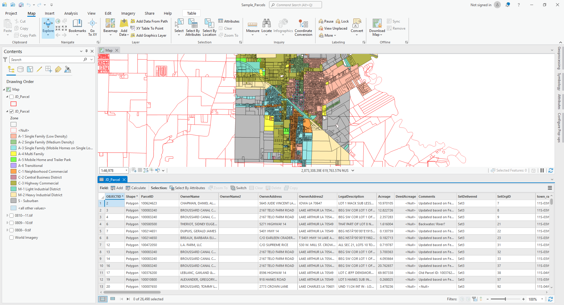
The Data
The quality of data can make or break decision-making, leading to costly mistakes and delays during and after the planning stages. USLandGrid puts reliable, up-to-date, and accurate information at your fingertips, empowering you to make critical decisions with confidence.
Our grid is the essential foundation for any high-quality map. USLandGrid's seamless, nationwide grid delivers comprehensive coverage, featuring detailed survey layers such as abstracts, sections, lots, and quarters. With industry-leading attributes tailored for landmen and land systems, we provide the precision and reliability
-
April 16, 2024
Infrastructure mapping isn't just about tracing lines and plotting points on a map. It's a fundamental group of layers that shapes the planning, building, and maintenance of the spaces we live in. It "bridges" the gap between theoretical planning and real world execution, ensuring developments are sustainable, efficient, and aligned with human and environmental needs.
You can now dive into a world of detail with our extensive infrastructure information, encompassing everything from roads, rivers and bridges to transmission lines, pipelines, wind turbines, power plants, and boundaries. Our data doesn't just skim the surface; it provides a deep dive into the geographical tapestry of your location.
-
May 15, 2023
The Power of Land Data: Unlocking the Potential with USLandGrid
In the world of maps, real estate, land developers, urban planners, utilities, and even government agencies, having access to accurate and up-to-date land data is essential for making informed decisions. Fortunately, USLandGrid provides a comprehensive solution by offering a wealth of information
-
-
April 16, 2018
Direct Streaming - An Easy Way to Consume Data
Streaming our data directly into your mapping software (or web mapping application) is an easier way to consume data without the management overhead of loading or updating data. Included in our stream is our fully featured land grid, our detailed culture, and other value added layers that enable you to build comprehensive and good looking maps in seconds. 

Streaming Land Data
Our streaming land data effortlessly streams into your
