 sales@uslandgrid.com
 Phone : 877-870-8872
ALL UPDATES INCLUDED FOR ONE YEAR
SOURCE: Bureau of Land Management
DELIVERED PROJECTION(S): Geographic (GCS) NAD27 Datum, Geographic (GCS) NAD83 Datum
FILES: Lease layer, Unit layer, ROW layer, Database Files
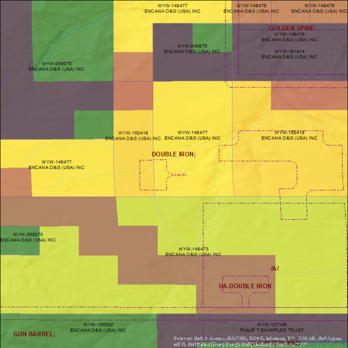
Lease Polygons with attributes - Top owner with Interest, HBP flag, Serial No, Expiration Data plus URL to Infopipe's Serial Number Page.
Unit Polygons with attributes of Unit, Operator, Serial No, plus URL to Infopipe's Serial Number Page.
Right-of-way Polygons with attributes of Holder/Applicant, Serial No, plus URL to Infopipe's Serial Number Page.
Closed Case Polygons with Closed Case Acreage (This acreage may be open and be able to be nominated.)
Access to Serial Register Page and Lot Database
Geoprocessed polygons features for Lease, Units, ROWs, and Open Cases. Primitive Data Simple (PDS) Format and Serial Register Page Access plus Access Databases with All Lessees and Intererests. All on our land grid. Lot Database Access included.
Attributes include 'bid per acre', 'expiration date', 'sale date', 'unit', 'lessee', and much more.