The store will not work correctly when cookies are disabled.
  • # sales@uslandgrid.com
  • # Phone : 877-870-8872
  • My Account
  • Checkout
  • News
  • Knowledge Base
  • Log In
Toggle Nav USLandGrid - Explore the Unexplored

Migrating your land grid system?

learn more
Search
HOME
DATA
LAND GRID
TAX PARCELS
INFRASTRUCTURE
OIL & GAS
FREE
WEST
Alaska
Arizona
California
Colorado
Idaho
Montana
Nevada
New Mexico
Oregon
Utah
Washington
Wyoming
MIDWEST
Illinois
Indiana
Iowa
Kansas
Michigan
Minnesota
Missouri
Nebraska
North Dakota
Ohio
South Dakota
Wisconsin
SOUTH
Alabama
Arkansas
Florida
Georgia
Kentucky
Louisiana
Mississippi
Oklahoma
Tennessee
Texas
CANADA
Alberta
Manitoba
Saskatchewan
WEST
Alaska
Arizona
California
Guam
Hawaii
Idaho
Montana
Nevada
New Mexico
Oregon
Utah
Washington
Wyoming
MIDWEST
Illinois
Indiana
Iowa
Kansas
Michigan
Minnesota
Missouri
Nebraska
North Dakota
Ohio
South Dakota
Wisconsin
SOUTH
Alabama
Arkansas
Florida
Georgia
Kentucky
Louisiana
Mississippi
North Carolina
Oklahoma
Puerto Rico
South Carolina
Tennessee
Texas
Virginia
NORTHEAST
Connecticut
Delaware
District of Columbia
Maine
Maryland
Massachusetts
New Hampshire
New Jersey
New York
Pennsylvania
Rhode Island
Vermont
West Virginia
WEST
Alaska
Arizona
California
Hawaii
Idaho
Montana
New Mexico
Nevada
Oregon
Utah
Washington
Wyoming
MIDWEST
Illinois
Indiana
Iowa
Kansas
Michigan
Minnesota
Missouri
Nebraska
North Dakota
Ohio
South Dakota
Wisconsin
SOUTH
Alabama
Arkansas
Florida
Georgia
Kentucky
Louisiana
Mississippi
North Carolina
Oklahoma
South Carolina
Tennessee
Texas
Virginia
West Virginia
NORTHEAST
Connecticut
Delaware
District of Columbia
Maine
Maryland
Massachusetts
New Hampshire
New Jersey
New York
Pennsylvania
Rhode Island
Vermont
West Virginia

Our oil and gas data includes well headers, formation tops, completion data, survey data, initial IPs, core data, casing information, perforations and monthly production. Multiple formats are available.

MIDWEST
Kansas
New Mexico
SOUTH
Oklahoma
Texas

Our free data includes boundary files like county boundaries, Texas Rail Road Commission boundaries, nationwide contours and state geology files. Free to download and use as you need.

BASINS

BOUNDARIES

CONTOURS

GEOLOGY

INDUSTRIES

Made for Industry


Discover top-tier GIS solutions tailored to your industry. 

ENERGY
UTILITIES
TELECOMS
FINANCE
FORESTRY
RAIL
MINING
SOLUTIONS

All our data, together, in an easily searchable platform.

Our solutions provide the most updated information with immediate access.

LAND GRID DATA
OWNERSHIP DATA
INFRASTRUCTURE DATA
WELL DATA
MAP PORTAL
DIGITIZATION

Our services include the basics of GIS mapping, to helping countless counties and organizations digitize hard copy maps and documents.

DIGITIZATION
HELP
SUPPORT
Coverage
Data Dictionaries
Data Migration
Datums and Formats
Videos
Terms of Use
ABOUT US
Brochures
Community
Partners
Team
Contact Us
CONTACT US

CONTACT US


 600 17th Street, Suite 2800S, CO 80202

 support@uslandgrid.com

 (877) 870-8872


OPENING HOURS


Mon - Fri: 8am - 5pm MST
Sat - Sun:
 Closed

MAPVERSE New!

Immediate access with all the formats for third party applications.

mapverse_small
My Cart
menu btn
×
  • Home
  • US Land Grid
  • US Wells
  • US Culture
  • US Parcels
  • USStreaming
  • Sample Data
Account

News

  • Home
  • News
Categories
  • News (40)
    • Well Logs (3)
    • Tax Parcels (22)
    • Oil and Gas Data (10)
    • Land Grid (25)
    • Cultural Data (6)
Recent Posts
When Disaster Strikes
October 20, 2025
2025 Tax Parcel Database Mid Year Review
July 24, 2025
Unlock Texas Land Secrets
July 10, 2025
Guide to Land Parcel Data
February 07, 2025
Customized GIS Data
Customized GIS Data
December 19, 2024
Archive
October 2025
July 2025
February 2025
December 2024
October 2024
August 2024
July 2024
June 2024
May 2024
April 2024
March 2024
June 2023
May 2023
May 2022
March 2022
July 2021
June 2021
September 2020
August 2020
August 2019
June 2019
May 2019
April 2019
December 2018
November 2018
April 2018
December 2017
November 2017
September 2017
March 2017
January 2017
November 2016
Tags
tax parcel data landgrid gis data land data tax parcels land grid gis land grid data tax parcel section township range land parcels gis services esri land ownership well logs texas parcel data plss well data aapg land maps open source web mapping tax parcel dataset community rugby sponsors oil and gas wells solar culture equality digitization digitize hard copy customized gis wind streaming legal boundaries log files texas survey map data updated annual convention custom gis oklahoma oil and gas data oil and gas space ice Infrastructure enterprise
  1. Tax Parcels Land Grid

    Complete Land Data

    Anthony Ford - March 08, 2022

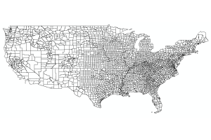
    Section Township Range AND Lots and Quarters and Quarter Quarters and Tax Parcels

    Most vendors think land data equals sections and townships, maybe boundaries. We realize that complete land data means just that. Our land grid includes sections, townships, quarters, quarter quarters, lots and boundaries. In Texas, we have the same depth and breadth of layers. Our tax parcels are the latest and greatest including the latest tax roll and the latest polygons.

    Incomplete Land Grid?

    Getting the most out of your data

    Most legal descriptions refer to lots and quarters. Your land data is going to need something that matches those legals. If you are mapping assets yourself, it's also going to be much easier if the land grid is sliced and diced

    Read more
  2. News Well Logs Tax Parcels Oil and Gas Data Land Grid

    Hard Copy Data No More

    July 12, 2021
    Hard Copy Data No More
    Read more
  3. News Oil and Gas Data Land Grid

    Lots of Lots of Quarters and Quarters

    June 25, 2021
    Lots of Lots and Quarters and Quarters
    Read more
  4. News Tax Parcels Oil and Gas Data Land Grid Cultural Data

    The BIG GIS Data Short

    September 18, 2020
    What is the source of your GIS data?
    Read more
  5. News Well Logs Tax Parcels Oil and Gas Data Land Grid

    What is the source of your GIS data?

    August 21, 2020
    What is the source of your GIS data?
    Read more
  6. News Land Grid

    Why are there differences in my land grid?

    August 19, 2019
    Why are there differences in my land grid?
    Read more
  7. News

    Supporting those who need support

    June 09, 2019
    As the owner of a company you are always balancing what is perceived by your customers. When it comes to opinions and politics we are told to be quiet so as not to offend anyone and hurt our revenue. That's really not okay... For those supporting real equality at a micro and macro level, for those supporting the underdog, for those who need help, and those who go against the popular view with open and full hearts, we are with you. We are not perfect, we may not always be right, but being a silent bystander is not an option...
    Read more
  8. News

    Oklahoma Oil and Gas Well and Production Data

    May 29, 2019
    We would like to proudly introduce the newest addition to our rapidly growing list of products: Oklahoma oil and gas well and production data. Once purchased, each delivery includes well headers, formation tops, completions, casings, surveys, initial potentials, perforations and monthly production - with monthly updates. All well data is delivered in WellBase Ascii4 format and CSV files, and is also available in Google BigQuery and GeoJSON. It is easy to import into LMKR GeoGraphix and Petra. Production dates back to 1987. Well records dating back to the early 1900s. Updated monthly. We only include the non-null data with no duplicates. Oklahoma Oil and Gas Well and Production data provides access to a staggering amount of data at your fingertips:
    • 474,000+ Well Records
    • 36,700,000+ Production Records
    • 150,000+ Formation Records
    • 140,000+ Completion Records
    • 44,000+ Casing Records
    • 50,000+ Perforation Records
    Read more
  9. News

    Proud Sponsors of Regis Rugby

    April 15, 2019
    USLandGrid has been sponsors of Regis University Rugby Club since 2018. By being active supporters, we help the students pay for necessary equipment and travel expenses. This year the club achieved new heights, reaching the sweet sixteen (out of 256 colleges). Over the last three years the club has been Rocky Mountain regional champions three times and Cowboy Cup champions once. Congratulations Regis Rugby on another record breaking season!
    Read more
  10. News Tax Parcels

    Tax Parcel Dataset Coverage

    December 04, 2018
    USLandGrid.com has a tax parcel database that includes all the major attributes including PID, owner name, mailing address, physical address, market value, tax zone, and many other attributes. They @USLandGrid now have over 3,000 counties of tax parcel data across the United States. All of Oklahoma was recently updated. The complete Oklahoma tax parcel dataset was just updated with 26+ attributes for each county.
    Read more
Page
  • Page Previous
  • Page 1
  • Page 2
  • You're currently reading page 3
  • Page 4
  • Page Next

Support

  • Check Order Status
  • Contact Us
  • Customer Information
  • Knowledge Base
  • Migrating Land Grid Systems
  • Order History
  • Videos

Information

  • About Us
  • Brochures
  • Coverage
  • News
  • Partners
  • Our Team
  • Terms of Use

Contact

  • Address: 600 17th Street, Suite 2800 South, Denver, Colorado 80202
  • Email: sales@uslandgrid.com
  • Phone: 877-870-8872

Subscribe

To automatically receive information about our GIS data news and recommended GIS workflows

  • |Search Terms|
  • Advanced Search |
  • Orders and Returns |
Cookie Notice
This website uses cookies to ensure you get the best user experience.
Accept Close More information
Cookie Settings