sales@uslandgrid.com
 Phone : 877-870-8872


-
October 20, 2025
At USLandGrid, we provide nationwide, up-to-date parcel and property data that integrates seamlessly into ArcGIS® Pro, ArcGIS® Online, and ArcGIS® Earth. Our datasets are refreshed constantly - most counties every 3-6 months, and over 90% of parcels updated within the past year - ensuring responders work from the most current and precise information available.

-
July 10, 2025
TEXAS IS TOUGH
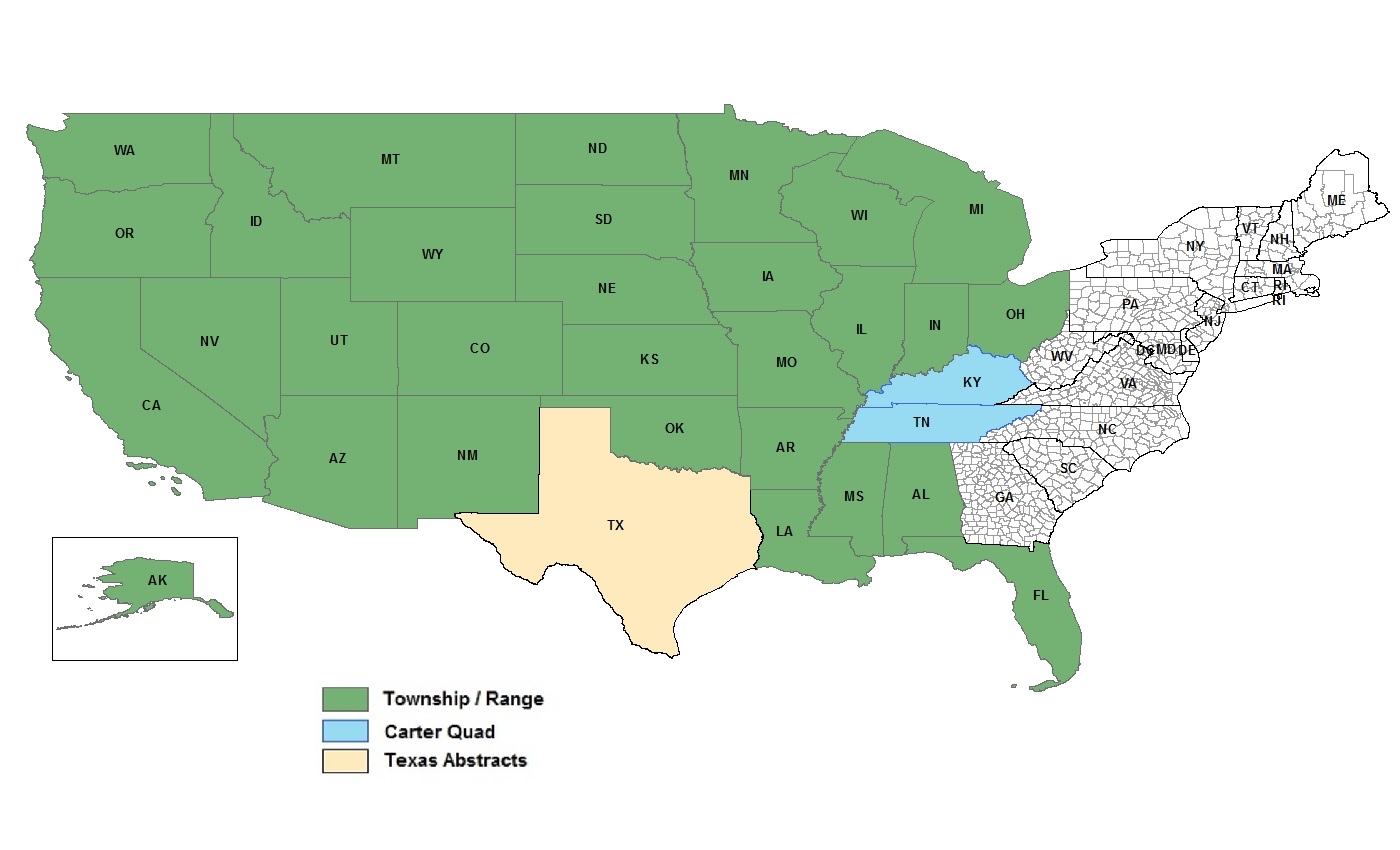
Texas is one of the toughest states when it comes to land grid accuracy. Overlapping abstracts, misaligned section lines, and public data that’s off by up to 1,000 feet??
Unfortunately, it’s all too common.
At USLandGrid, we decided enough was enough. We took action to bring clarity, precision, and reliability to the Texas land grid.
▪ Corrected overlapping abstracts
▪ Replaced outdated sources
▪ Created near-survey-grade land grid layers you can trustWhat does that mean for you?
A cleaner, smarter way to plan. Our land grid now:▪ Aligns with roads and infrastructure
▪ Doesn't cut through well pads
▪ Gives you peace of mind in high-stakes projects -
February 07, 2025

In today's data-driven landscape, access to accurate and comprehensive land parcel data is essential for informed decision-making across various industries. This guide delves into the significance of nationwide parcel data, its applications, and the solutions available to meet diverse needs.
Understanding Land Parcel Data
Land parcel data encompasses detailed information about property boundaries, ownership, land use, zoning, and other pertinent
-
December 19, 2024
Unique Data Requirements?
 We understand that every customer has unique data requirements. That’s why we go beyond just delivering a project—we ensure seamless integration by providing data in multiple formats, projections, and schemas, customized to fit your workflow.
Our data is delivered in various formats at no extra cost, including FGDB, Shapefiles, KML, CDF, CSV, Excel, DXF, and WB4—ensuring compatibility with the tools you use. We also accommodate specific datums, projections, and schema adjustments to align with your internal systems.
Need dissolves, additional fields like surveyed acres, or custom schema modifications for easier integration? We’ve got you covered. Our goal is simple: to make your data accessible, adaptable, and ready for immediate use. -
October 16, 2024
Looking to Transition from an Outdated Land Grid?
Before making the move, it’s essential to consider these questions:
- Does your current land grid provide a full picture, including lots, quarters and quarter quarters, or is it limited to sections and townships?
- Is the data user-friendly and easy to implement across company projects?
- Are the datasets seamless and contiguous, eliminating data gaps?
- How is your current data structured—leased or owned, and what’s the cost impact on your organization?
- What delivery formats are available to streamline integration?
At USLandGrid, we provide end-to-end support for companies moving off their old land grid. From exiting existing contracts to finding and replacing outdated grids, and spatially adjusting internal polygons, we ensure a seamless transition every step of the way.
We’re committed to providing data solutions that are current, detailed, and seamlessly integrate into
-
August 14, 2024
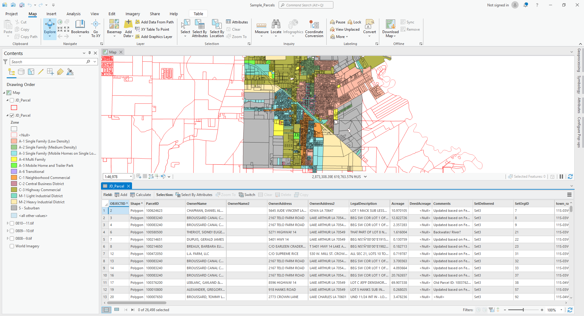
Geospatial Datasets
With instant access to precise grid data, ownership details, and well information, our users gain real-time insights into competitor activities. This empowers them to make informed decisions swiftly, transforming how they plan and evaluate new opportunities.
The Data
The quality of data can make or break decision-making, leading to costly mistakes and delays during and after the planning stages. USLandGrid puts reliable, up-to-date, and accurate information at your fingertips, empowering you to make critical decisions with confidence.
Our grid is the essential foundation for any high-quality map. USLandGrid's seamless, nationwide grid delivers comprehensive coverage, featuring detailed survey layers such as abstracts, sections, lots, and quarters. With industry-leading attributes tailored for landmen and land systems, we provide the precision and reliability
-
July 31, 2024
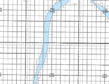
Land grid data is basically the information that maps out land into a grid or network, based on set coordinates or natural landmarks. These grids help to identify, manage, and keep track of different land assets.
Thomas Jefferson is synonymous with this land grid. As the father behind westward expansion and distribution of the land that came with it, he believed that dividing the land into uniform parcels through the Public Land Survey System (PLSS) would encourage land ownership and participation in the new territories.
-
May 21, 2024
At USLandGrid, we understand that the foundation of accurate and reliable land data lies in the source. That’s why we pride ourselves on providing the most precise, up-to-date, and detailed land grid data available. Our commitment to excellence drives us to always refer back to the original sources, ensuring that our clients receive the highest quality information.
-
May 13, 2024
Acres and sections are both units of measurement used to determine the area of land. In the matter of land measurements, understanding the relationship between acres and sections is imperative. In this blog post, we will explore how many acres are in a section of land and how to convert between these units of measurement.

-
March 25, 2024
Imagine facing a costly dispute due to conflicting land surveys. It's a high-stakes situation many in the oil and gas sector dread. In any land asset-driven industry, discrepancies between different land surveys can lead to significant conflicts and delays. One of our clients faced this exact problem, with two opposing surveys (one based on metes and bounds and the other from an apparent survey marker) casting doubt on the boundaries of their operational field.