The store will not work correctly when cookies are disabled.
  • # sales@uslandgrid.com
  • # Phone : 877-870-8872
  • My Account
  • Checkout
  • News
  • Knowledge Base
  • Log In
Toggle Nav USLandGrid - Explore the Unexplored

Migrating your land grid system?

learn more
Search
HOME
DATA
LAND GRID
TAX PARCELS
INFRASTRUCTURE
OIL & GAS
FREE
WEST
Alaska
Arizona
California
Colorado
Idaho
Montana
Nevada
New Mexico
Oregon
Utah
Washington
Wyoming
MIDWEST
Illinois
Indiana
Iowa
Kansas
Michigan
Minnesota
Missouri
Nebraska
North Dakota
Ohio
South Dakota
Wisconsin
SOUTH
Alabama
Arkansas
Florida
Georgia
Kentucky
Louisiana
Mississippi
Oklahoma
Tennessee
Texas
CANADA
Alberta
Manitoba
Saskatchewan
WEST
Alaska
Arizona
California
Guam
Hawaii
Idaho
Montana
Nevada
New Mexico
Oregon
Utah
Washington
Wyoming
MIDWEST
Illinois
Indiana
Iowa
Kansas
Michigan
Minnesota
Missouri
Nebraska
North Dakota
Ohio
South Dakota
Wisconsin
SOUTH
Alabama
Arkansas
Florida
Georgia
Kentucky
Louisiana
Mississippi
North Carolina
Oklahoma
Puerto Rico
South Carolina
Tennessee
Texas
Virginia
NORTHEAST
Connecticut
Delaware
District of Columbia
Maine
Maryland
Massachusetts
New Hampshire
New Jersey
New York
Pennsylvania
Rhode Island
Vermont
West Virginia
WEST
Alaska
Arizona
California
Hawaii
Idaho
Montana
New Mexico
Nevada
Oregon
Utah
Washington
Wyoming
MIDWEST
Illinois
Indiana
Iowa
Kansas
Michigan
Minnesota
Missouri
Nebraska
North Dakota
Ohio
South Dakota
Wisconsin
SOUTH
Alabama
Arkansas
Florida
Georgia
Kentucky
Louisiana
Mississippi
North Carolina
Oklahoma
South Carolina
Tennessee
Texas
Virginia
West Virginia
NORTHEAST
Connecticut
Delaware
District of Columbia
Maine
Maryland
Massachusetts
New Hampshire
New Jersey
New York
Pennsylvania
Rhode Island
Vermont
West Virginia

Our oil and gas data includes well headers, formation tops, completion data, survey data, initial IPs, core data, casing information, perforations and monthly production. Multiple formats are available.

MIDWEST
Kansas
New Mexico
SOUTH
Oklahoma
Texas

Our free data includes boundary files like county boundaries, Texas Rail Road Commission boundaries, nationwide contours and state geology files. Free to download and use as you need.

BASINS

BOUNDARIES

CONTOURS

GEOLOGY

INDUSTRIES

Made for Industry


Discover top-tier GIS solutions tailored to your industry. 

ENERGY
UTILITIES
TELECOMS
FINANCE
FORESTRY
RAIL
MINING
SOLUTIONS

All our data, together, in an easily searchable platform.

Our solutions provide the most updated information with immediate access.

LAND GRID DATA
OWNERSHIP DATA
INFRASTRUCTURE DATA
WELL DATA
MAP PORTAL
DIGITIZATION

Our services include the basics of GIS mapping, to helping countless counties and organizations digitize hard copy maps and documents.

DIGITIZATION
HELP
SUPPORT
Coverage
Data Dictionaries
Data Migration
Datums and Formats
Videos
Terms of Use
ABOUT US
Brochures
Community
Partners
Team
Contact Us
CONTACT US

CONTACT US


 600 17th Street, Suite 2800S, CO 80202

 support@uslandgrid.com

 (877) 870-8872


OPENING HOURS


Mon - Fri: 8am - 5pm MST
Sat - Sun:
 Closed

MAPVERSE New!

Immediate access with all the formats for third party applications.

mapverse_small
My Cart
menu btn
×
  • Home
  • US Land Grid
  • US Wells
  • US Culture
  • US Parcels
  • USStreaming
  • Sample Data
Account

Oil and Gas Data

  • Home
  • News
  • News
  • Oil and Gas Data
Categories
  • News (40)
    • Well Logs (3)
    • Tax Parcels (22)
    • Oil and Gas Data (10)
    • Land Grid (25)
    • Cultural Data (6)
Recent Posts
When Disaster Strikes
October 20, 2025
2025 Tax Parcel Database Mid Year Review
July 24, 2025
Unlock Texas Land Secrets
July 10, 2025
Guide to Land Parcel Data
February 07, 2025
Customized GIS Data
Customized GIS Data
December 19, 2024
Archive
October 2025
July 2025
February 2025
December 2024
October 2024
August 2024
July 2024
June 2024
May 2024
April 2024
March 2024
June 2023
May 2023
May 2022
March 2022
July 2021
June 2021
September 2020
August 2020
August 2019
June 2019
May 2019
April 2019
December 2018
November 2018
April 2018
December 2017
November 2017
September 2017
March 2017
January 2017
November 2016
Tags
tax parcel data landgrid gis data land data tax parcels land grid gis land grid data tax parcel section township range land parcels gis services esri land ownership well logs texas parcel data plss well data aapg land maps open source web mapping tax parcel dataset community rugby sponsors oil and gas wells solar culture equality digitization digitize hard copy customized gis wind streaming legal boundaries log files texas survey map data updated annual convention custom gis oklahoma oil and gas data oil and gas space ice Infrastructure enterprise
  1. News Tax Parcels Oil and Gas Data Land Grid

    When Disaster Strikes

    Anthony Ford - October 20, 2025

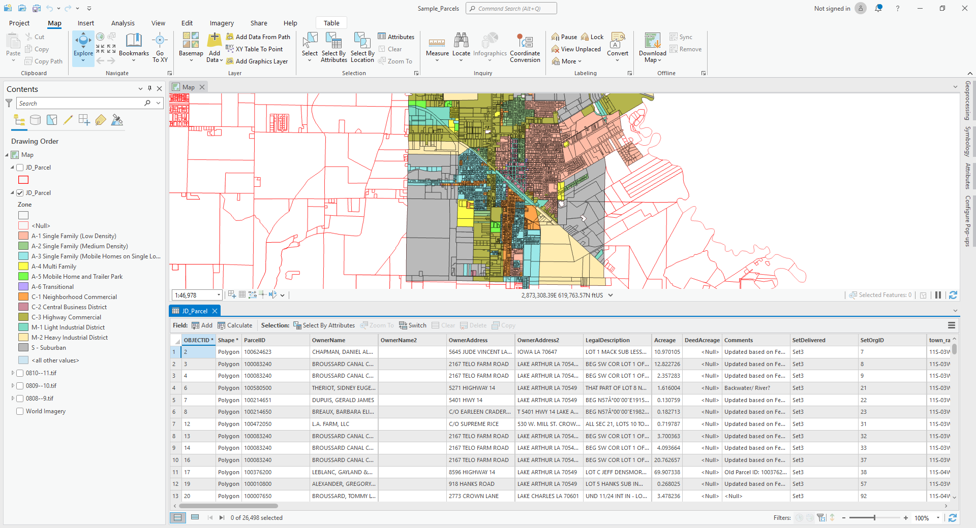
    At USLandGrid, we provide nationwide, up-to-date parcel and property data that integrates seamlessly into ArcGIS® Pro, ArcGIS® Online, and ArcGIS® Earth. Our datasets are refreshed constantly - most counties every 3-6 months, and over 90% of parcels updated within the past year - ensuring responders work from the most current and precise information available.

    Disaster
    Read more
  2. News Tax Parcels Oil and Gas Data Land Grid Cultural Data

    Customized GIS Data

    Anthony Ford - December 19, 2024

    Unique Data Requirements?

    We understand that every customer has unique data requirements. That’s why we go beyond just delivering a project—we ensure seamless integration by providing data in multiple formats, projections, and schemas, customized to fit your workflow. 
     
    Our data is delivered in various formats at no extra cost, including FGDB, Shapefiles, KML, CDF, CSV, Excel, DXF, and WB4—ensuring compatibility with the tools you use. We also accommodate specific datums, projections, and schema adjustments to align with your internal systems. 
     
    Need dissolves, additional fields like surveyed acres, or custom schema modifications for easier integration? We’ve got you covered. Our goal is simple: to make your data accessible, adaptable, and ready for immediate use.

    Read more
  3. News Tax Parcels Oil and Gas Data Land Grid Cultural Data

    Scalable Datasets

    Anthony Ford - August 14, 2024

    Geospatial Datasets

    With instant access to precise grid data, ownership details, and well information, our users gain real-time insights into competitor activities. This empowers them to make informed decisions swiftly, transforming how they plan and evaluate new opportunities.


    The Data

    The quality of data can make or break decision-making, leading to costly mistakes and delays during and after the planning stages. USLandGrid puts reliable, up-to-date, and accurate information at your fingertips, empowering you to make critical decisions with confidence.

    Our grid is the essential foundation for any high-quality map. USLandGrid's seamless, nationwide grid delivers comprehensive coverage, featuring detailed survey layers such as abstracts, sections, lots, and quarters. With industry-leading attributes tailored for landmen and land systems, we provide the precision and reliability

    Read more
  4. News Well Logs Tax Parcels Oil and Gas Data Land Grid

    Hard Copy Data No More

    July 12, 2021
    Hard Copy Data No More
    Read more
  5. News Oil and Gas Data Land Grid

    Lots of Lots of Quarters and Quarters

    June 25, 2021
    Lots of Lots and Quarters and Quarters
    Read more
  6. News Tax Parcels Oil and Gas Data Land Grid Cultural Data

    The BIG GIS Data Short

    September 18, 2020
    What is the source of your GIS data?
    Read more
  7. News Well Logs Tax Parcels Oil and Gas Data Land Grid

    What is the source of your GIS data?

    August 21, 2020
    What is the source of your GIS data?
    Read more
  8. News Oil and Gas Data

    GIS and Mapping Services

    December 01, 2017

    GIS and Mapping Services

    USLandGrid's team of GeoExperts provide cutting edge GIS solutions to companies across the oil and gas industry. We support exploration programs consisting of historical data compilations with geological, geochemical, drill hole, tenement and geophysical map vectorization, data transcription, and translation.
    Exploration GIS Services
    With extensive experience in compiling data from varied time frames and formats, our GeoExperts are capable of pulling out all the necessary data from historical exploration reports such as, drill hole collars, assays, drill lithology logs, geophysical downhole logs and its location specific data; geochemical assays, assay method types, etc.
    Read more
  9. News Well Logs Oil and Gas Data

    AAPG Mid-Continent Section Meeting

    September 17, 2017

    AAPG Mid-Continent Section Meeting

    See you next week!
    Upgrade your land grid with more details, more layers, and better resolution. Focusing on geology and land, we help the enterprise work seamlessly together with our data. - Booth # 34.
     
    We also have some great give aways!
    Read more
  10. News Oil and Gas Data

    AAPG Annual Convention & Exhibition (ACE)

    March 28, 2017

    AAPG Annual Convention & Exhibition (ACE)

    See you next week! Found out more about our high resolution data that includes land grid, wells, culture, tax parcels and logs at booth # 1243. We also have some great give aways!
    Read more

Support

  • Check Order Status
  • Contact Us
  • Customer Information
  • Knowledge Base
  • Migrating Land Grid Systems
  • Order History
  • Videos

Information

  • About Us
  • Brochures
  • Coverage
  • News
  • Partners
  • Our Team
  • Terms of Use

Contact

  • Address: 600 17th Street, Suite 2800 South, Denver, Colorado 80202
  • Email: sales@uslandgrid.com
  • Phone: 877-870-8872

Subscribe

To automatically receive information about our GIS data news and recommended GIS workflows

  • |Search Terms|
  • Advanced Search |
  • Orders and Returns |
Cookie Notice
This website uses cookies to ensure you get the best user experience.
Accept Close More information
Cookie Settings